Saturday, May 19, 2012

Channel Islands - Santa Cruz Island Hike


Santa Cruz Island/Smugglers Cove is one of my favorite hikes because I hope to catch a glimpse of one of four native local inhabitants, the curious, shy, and ever elusive island fox,  their ancestors "rafted" to the Channel Islands 10,400 to 16,000 years ago.  Also, the two-hour sail to the islands is adventurous, passing over the "wind channel" and crossing the migration paths of gray whales and most recently the feeding grounds of a pod of transient Orcas can be quite exhilarating! Hundreds and hundreds of spinner dolphins are common to see, and they love to catch up and challenge the boat to a race along the way.  The Channel Islands are also the breeding grounds of the brown pelican and California sea lions.  There are 80,000 sea lions that live and breed on the islands, and the pelican has made a huge comeback after the 1950's scare of DDT and thin eggs almost wiped them out.  They have actually been de-listed on the endangered species act! 
Spinner dolphins
Transportation to the islands can be found through Channel Islands Charter  for packages that include day excursions/whalewatching trips or overnight stays/extended trips on sailing or power yachts, or Island Packers has overnight camping (you camp on the island) and daytrips/whale watching tours. There is also an airstrip on one of the islands, but I have never checked into flights.  I prefer the boat trip through Channel Islands Charter, as there is an extremely high probability that you will see amazing marine life on the way! 

Orca   a few miles off of Anacapa Island

Sunning or feeling the sails fill with wind is very relaxing and exciting, but every once in awhile look around as you travel to the island. Your adventure has officially begun.  Don't forget to bring binoculars, but first scan the horizon with the naked eye.  Look for a concentration of flying birds and/or whitewater (the splashing of seals or dolphins) during calm seas.  This usually means a feeding frenzy on a baitball (lots of fish).  You can usually talk Captain Sean into following the baitball for a photo op, or to attract playful dolphins to chase the boat.  

Smugglers Cove
  Once you are anchored, you can either kayak or take an inflatable motorboat to shore.  Bring sunscreen, water, flipflops or some sort of footgear that can get wet, snacks, and hiking shoes. Smugglers Cove was actually used as a hideout for smugglers in the 1800's who would store their goods for a time. Long before that, Santa Cruz Island was home to the largest population of the Island Chumash Indian tribe.  In fact, archaeological finds on the island trace human inhabitants that lived there over 9000 years ago!  The earth that you are touching is rich in history!  The first part of the hike goes through the Gherini family hunting lodge and buildings, once used to lodge hunters that would come to the island to hunt feral pigs.  The Gherini family also had a sheep ranch on the island, until they sold the property to the  federal government, unwillingly in the 1990's, and now it is a National Park.  

At the Gherini buildings, we had the pleasure of meeting one of only four native animals to the island, the island fox.  This is the animal that has eluded me for years, its ancestors arriving tens of  thousands of years ago on "rafts".  Now, the island fox is endangered, due to the golden eagles overhunting them.  This is a lesson in what happens when we mess with the eco-chain.  Bald eagles used to be plentiful on the islands, but when the DDT event happened in the 1950's that thinned the eggs of the nesting brown pelican and bald eagle, the eagle disappeared from the islands.  The golden eagle was sighted, and filled in as the top predator, feeding on feral pigs that were also introduced to the island, and the island fox.  Once the feral pigs were removed from the island, the golden eagle fed on the island fox.  The fox went from a population of 2000 adults in 1994 to 135 adults in 2000.  


A rare glimpse of an island fox
Bat cavern

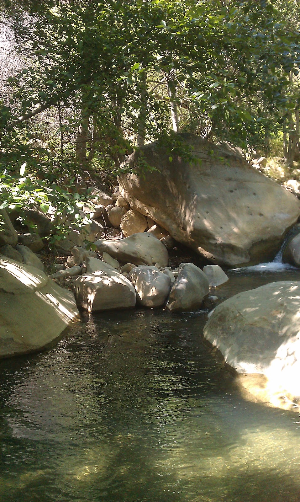
 Follow the riverbed, and you will discover caves alongside the cliffs.  Santa Cruz Island has eleven species of bats, including the rare Townshend's long-eared bats, who roost upside down and unlike other bat colonies, will not crawl in between nooks and crannies but prefer to keep their fur fluffy and hang upside down in large caverns, like the one we found that really smelled and looked like it was inhabited by bats!


 Hike up the canyon to the hills, and follow the trail back to the ocean.  
This hike is strenuous as the riverbed is unmarked and there is boulder hopping, but there are other well-marked hikes out of Smugglers Cove that are easier and connect the other anchorages in the area.  

Sunday, May 13, 2012

Matilija Canyon Ranch Wildlife Refuge


The horse that got spooked!
When June Gloom has got you down, theres a sunny spot in the mountains with natural swimming pools just off the 101 Freeway and Highway 33.  Matilija Canyon is located in the mountains above Ojai, California,  about an hour and fifteen minutes from West Malibu.  Even during busy weekends, you can find a vacant swimming hole if you are adventurous!  The hike is easy, mostly flat and well marked, and about 2 miles one way.  After the hike, you can stop at the Deer Lodge and hang with the bikers and locals, or you can stroll through the quaint town of Ojai, get an ice cream at the local candy store, and perhaps hear live music at the park.  There's also amazing smoked salmon at  one of the smaller grocery stores in Meiners Oaks.  It tastes like it was smoked and flavored with molasses!  I have been known to stop there first and take it on the hike with me!


Sweetbroom flowers
The trail begins through a private ranch, with peacocks, geese, donkeys and free range horses.  It also crosses a large riverbed and a smaller river a few times.  Its mainly a sunny hike although there are pine trees and oak trees along the way. In the spring, there are yellow sweetbroom, purple lupines, red larkspur, and white towering Our Lords Candle flowers are abundant on the trail.  You will cross riverbeds and smaller streams a few times, but if you are well-balanced, there are quite a few rocks to hop to and you won't get wet.  As always, bring water, because it gets hot in Ojai, sometimes in the triple digits in the summer. 


To get to Ojai, take PCH to 101 and follow signs to Ventura.  On the north side of Ventura, take Highway 33 to Ojai.  You will stay on 33 for approximately 14 miles. Turn left at the light and follow the signs to Maricopa Highway.There will be a Vons store at the corner where you turn, and you will pass Nordhoff High School on the left.  In 5 miles you will pass about 5 mailboxes on the left, and you will see a road that goes straight up on the left.  Turn left and take this road, Matilija Rd.  


 It is a windy narrow road that will dead end after 5 miles, with abundant dirt parking at trailhead.  Walk through Matilija Canyon Ranch, enjoy the animals and fruit trees, then continue on well marked dirt trail.  You will cross a small stream once, then cross the riverbed twice, then follow the trail to the Y.  At the Y, you will take the smaller trail to the right, marked "North Fork" .  You will cross a stream three more times. After the third time, the riverbed will be on your right.  Look for campgrounds, with stone circles for bonfires and small bbq's.  Get off the trail and look for a swimming hole once you get to the campgrounds.  
One of the shoulder-deep waterholes,  with
 plenty of flat rocks to sun on or picnic on.

The riverbed on the way back.

Tuesday, May 1, 2012

Dead Horse Trail to Eagle Rock

Eagle Rock is amazing.  I remember the first time I was on this hike, I was expecting a boulder outcrop like Sandstone Peak. At the last leg of the hike, you turn a bend and see Eagle Rock for the first time.  So that's what all the fuss is about!   In comparison to Sandstone Peak, Eagle Rock is huge.  See the photo below and notice how small the people are! And the hike through meadows and oaks is beautiful.   I like the loop, so it looks like this:  Dead Horse to Musch to Eagle Rock Fire Road to Eagle Rock.  For the return trip, back down the fire road and continue past the Musch trailhead.  Now you are on Eagle Springs Fire Road, follow that to a trail that breaks to the right, and will lead to Trippet Ranch.  Cross the bridge and get back on Dead Horse trail to Entrada Rd. This  is a very popular trail, but the trek from Dead Horse to Trippet Ranch isn't as well traveled, and it goes through meadows and woodland which is green and colorful (lots of different kinds of wildflowers) after a rain.
From Pacific Coast Highway, take Topanga Canyon for  4.7 miles, past the little town of Topanga  to Entrada Rd.  Turn right and go about .1 mile.  There are a few spots to park underneath big trees in a dirt shoulder to the right.  Dead Horse trail is across the street.
Eagle Rock
Its about .4 miles to Trippet Ranch, and with only 100 ft. elevation gain, its an easy trail.  We have seen deer in the meadows!  Enjoy the shade of the oaks and the peacefulness of lone traveling, because you'll have company once on the Musch Trail.  There are bathroom facilities in the parking lot at Trippet Ranch, turn right off the Dead Horse Trail to access these.  If not, cross the road and turn left to get to Musch Trailhead.
The 2.1 miles of the Musch Trail will be shady and oak-lined, and you will have a 620 ft. elevation gain...the trail starts out easy but it does get steep near the end.
Musch trail ends at "The Hub", a place where a few trails intersect.  Turn left at end of trail to continue up, up, up to Eagle Rock via Eagle Rock fire road, about .5 mile hike.  Its hot and steep, and you don't see the rock until halfway through, then you get a second wind because it is HUGE and you want to get there and hang your feet over the edge.  Well, maybe not, but at least climb to the top.


Eagle Springs FR. Eagle Rock in background.
On the descent, pass Musch Trail and continue on the fire road, which turned into Eagle Springs Fireroad. Take  It is a 2 mile trek to Trippet Ranch from Eagle Rock. Cross over the bridge and turn left to catch the .4 mile long Dead Horse trail back to car.


Total hike distance is about 5.5 miles, mostly shade, but the fire roads can get super hot and make the 900 ft. elevation gain strenuous.  I also recommend going with someone who has hiked this trail, as with any others near Topanga because the intersecting trails can be confusing. Hike in early morning to escape crowds and heat!


Puerco Canyon Hike


The Puerco Canyon Hike affords beautiful views of the Pacific Ocean while you carve them glutes! The trailhead is located up Puerco Canyon, a little obscure road about a mile east of Malibu proper on Pacific Coast Highway. If you're a local Bu'ite, the street is across from Cher's house. Drive up about 1 mile to end...and trailhead.  
We hiked 5.6 miles one way, about 2 hours. Hike is intermediate, all uphill on the way up, but not so steep. Full sun hike. Veer to left at trail fork...going to the right will take you to Malibu Creek.
We saw deer, coyote and crows dancing in updraft. Lovely views of coast, lakes and Calabasas.